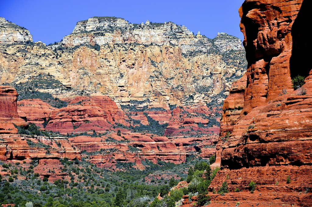
Our Picks: The 10 Best Sedona Hikes
We asked our friends over at The Hike House and some of our avid hikers on staff to give us their picks for the best Sedona hikes. We compiled a comprehensive list of these 10 best Sedona hikes that you definitely shouldn’t miss. Whether you’re a hiking novice or an expert trailblazer, our round-up will help you plan idyllic trail time during your next Sedona adventure.
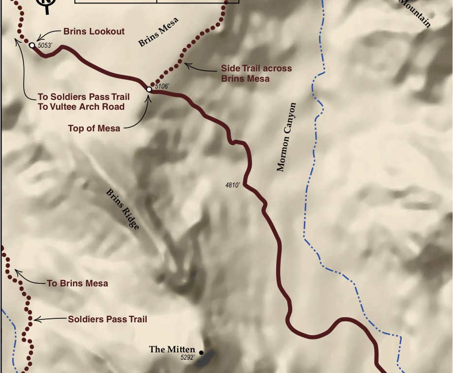
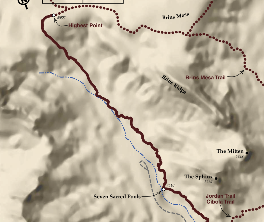
Brins Mesa
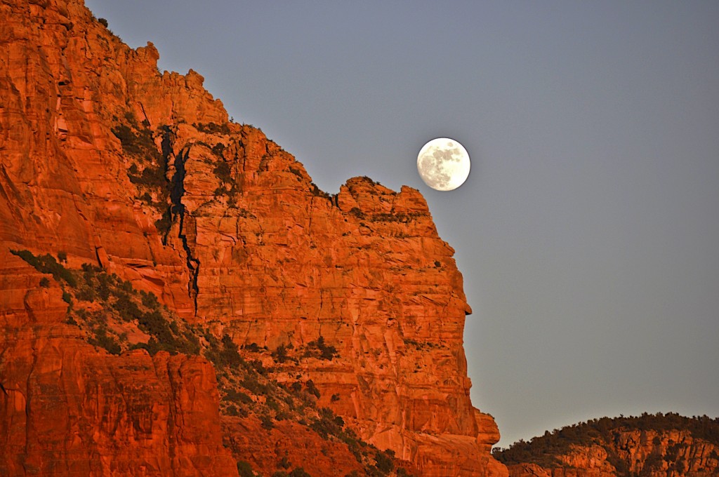
Beneath the highest structure in Sedona, Wilson Mountain, lies an exquisite trail that takes you up 500 feet to a mesa overlooking Mormon Canyon and Soliders Pass. If you are looking to add to your adventure, then consider going right at the top of the mesa (see “Side Trail” on map) for an additional 1.0 mile and 400 feet elevation or connecting to the Soldiers Pass Trail. For those looking for an even longer adventure then take Brins Mesa Trail out to FR 152 (Vultee Arch Road), connect to Chuck Wagon Trail then over to Devil’s Bridge for a 5.7 mile (one way)/11.4 mile (round trip).
Directions
Start at L’Auberge. Right onto 89A 0.3 miles. Left onto Jordan Rd 0.8 miles. Left onto W. Park Ridge Rd 0.7 miles (Last section is a decent dirt road). Arrive at Brins Mesa Trailhead parking
Insider Info
The real “wow” factor of this hike and the reason why I keep coming back to this trail is the spectacular views you obtain once you crest the top of this mesa. From here you overlook the Secret Canyon Wilderness which one of the most secluded and untouched areas of Sedona. Another great aspect of this hike is about 1.65 miles in on the hike where you will come across a neat red rock knoll just off to the side of the trail. It is an amazing little perch to quickly climb up and enjoy a lunch with 360 degree view. – Greg Hanss, Managing Director
Soldiers Pass
Soldiers Pass Trail is a moderate trail that offers a back country feel yet is almost located in the middle of town. Sandwiched between Brins Ridge and Capitol Butte (a.k.a. Thunder Mountain), this trail offers everything you would expect from a great trail. The trail rolls through a number of arroyos, past the area’s largest sinkhole (Devils Kitchen), along the “Seven Sacred Pools,” then up 509 feet atop Brins Mesa. The highlight of the trail is the impressive sinkhole which was reported as a major collapse event in the 1880’s (retold by Albert E. Thompson in 1968) and then a secondary event in 1989 increased the size of the sinkhole by 1/3 (large block on the northern wall).
Details
- Hiking Distance: One-Way: 2.0 mi | Total: 4.0 mi
- Trail Difficulty: Moderate
- Elevation Min/Max: 4407 to 4916 ft
- Hiking Time: One Way: 1 hr | Total: 2 hrs
- Trailhead GPS Coordinates: 34°53.066’ N, 111°47.020’ W
- Parking at Trail: 30 spaces
Directions
Start at L’Auberge. Left onto 89A 1.4 miles. Right onto Soldiers Pass Rd 1.4 miles. Right onto Rim Shadow Rd 0.2 miles. Straight on Canyon Shadows 300 yds. Arrive at Soldiers Pass Trailhead – parking is on left.
Insider Info
Soldier Pass Trail has a little bit of everything one could hope for in a classic Sedona hike. Hikers will enjoy beautiful sweeping views of the red rocks, unique geology in the form of a massive sinkhole, hidden natural arches, and walk in the footsteps of both the US Calvary and the Sinagua Indians native to the Sedona area. The US cavalry came through what would become Sedona at the turn of the 19th century. General George Crook and his soldiers blazed a trail along an old Indian footpath which connected a perennial water source, the Seven Sacred Pools, to the lush valley of the Dry Creek Basin. What was then Camp Garden, a cool, shady area where Crook and his soldiers made camp, is now the location of one of Sedona´s top hiking trails, the Soldiers Pass Trail. – Graham Parker, Concierge
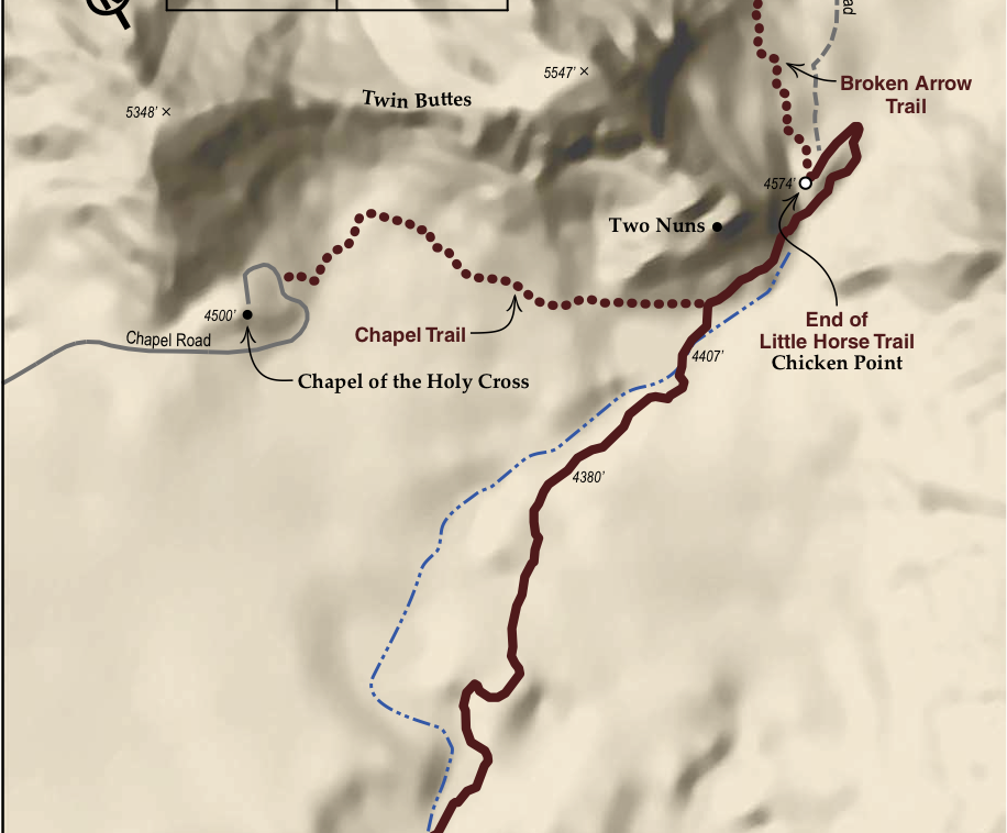
Little Horse
Beautiful easy to moderate trail that rolls across the Red Rock landscape through a number of dry creek washes (arroyos) and then crescendos atop Chicken Point. Beautiful views of Cathedral Rock, Courthouse / Bell Rock, Gibraltar Rock and Munds Wilderness at the end. To heighten your experience consider taking a side hike over to the Chapel of the Holy Cross or continue past Chicken Point and check out Submarine Rock via Broken Arrow Trail.
Details
- Hiking Distance: One-Way: 1.7 mi | Total: 3.4 mi
- Trail Difficulty: Easy to Moderate
- Elevation Min/Max: 4193 to 4508 ft
- Hiking Time: One Way: 45 min | Total: 1.5 hrs
- Trailhead GPS Coordinates: 34° 49.456’N, 111° 46.505’W
- Parking at Trail: 23 spaces
Directions
Start at L’Auberge. Left on 89A 0.2 miles. Left onto Hwy 179 South 3.5 miles (Watch for Little Horse Sign after Back O’ Beyond roundabout. Cross over divided highway). Arrive at Little Horse Trailhead on the left.
Insider Info
If there is one trail that has all of the features of Sedona that I love, Little Horse is it. Views of Sedona’s most memorable formations in the distance and then a gentle incline to chicken point where I am surrounded by awe inspiring spires such as the two nuns. Also, when most people tend to shy away from the trails during or after a heavy rain I gravitate to Little Horse trail. Watching the dry washes of the trail come to life and put forth small waterfalls is like an elixor for the soul. – Jesse Alexander, General Manager
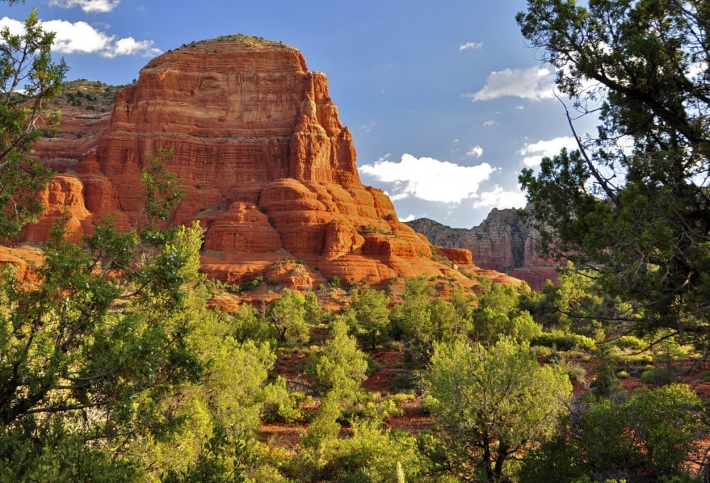
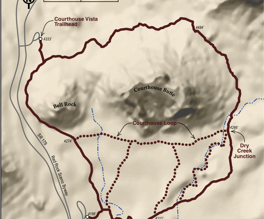
Courthouse/Bell Rock
Courthouse Butte Loop Trail is a great moderate hike for the whole family. Do not let the “carnival” at Bell Rock discourage you from doing this trail. While many come to “play” on Bell Rock, they are truly missing the best part of the area. The real gem of this area is in doing the entire loop. You will have a choice on the southern side of Courthouse of doing the Courthouse Loop or taking the Big Park Loop (preferred). As you loop around the eastern and northern side of this great butte, you will unlock the most scenic, tranquil and upclose views of the trail. As you come around the northern side of Courthouse, do not miss the cluster of Ocotillo just below the smaller butte that some affectionately call “Pancake Rock.”
Details
- Hiking Distance One-Way/Total: 4.2 miles
- Trail Difficulty: Easy to Moderate
- Elevation Min/Max: 4060 to 4511 ft
- Hiking Time One Way/Total: 2.25 hours
- Trailhead GPS Coordinates: 34° 48.343’N, 111° 45.980’W
- Parking at Trail: 55 spaces
Directions
Start at L’Auberge. Left onto 89A .2 miles. Left onto Hwy 179 4.7 miles (Pass through 4 roundabouts). Left into Courthouse Vista Parking lot. Travel an additional 1.1. miles to Bell Rock Vista Parking. Arrive at Courthouse/Bell Rock. Trailhead is on left.
Insider Info
Courthouse and Bell Rock Trails were actually my first hikes when I moved to Sedona. Not only are they magnificent trails because of the nature you are surrounded by but also because they each have a different energy you can feel when you hike them. Courthouse’s energy is very calming and serene, not in the sense where the hike is relaxed but rather your mind goes into a quiet place and you are embraced by the beauty of Courthouse Butte. As for Bell Rock, I cannot say it enough how much this hike brings out the inner child in me. Its wonderful playful energy is brought out because of all the different ways you can take to experience it. It allows you to choose a path best for you and encourages you along the way! To be honest and not mislead anyone, it is a steep hike, especially if you intend to reach the top to sign your name in the geocache box. But anything worth achieving is worth working for. I was privileged to have friends who helped me to the top my first time and what a glorious view it was; to this day it is still one of my top 3 favorite hikes. However, I believe anyone who has the ambition and a little courage can make it to the top of the majestic Bell Rock. – Veronica Espada, Spa Coordinator
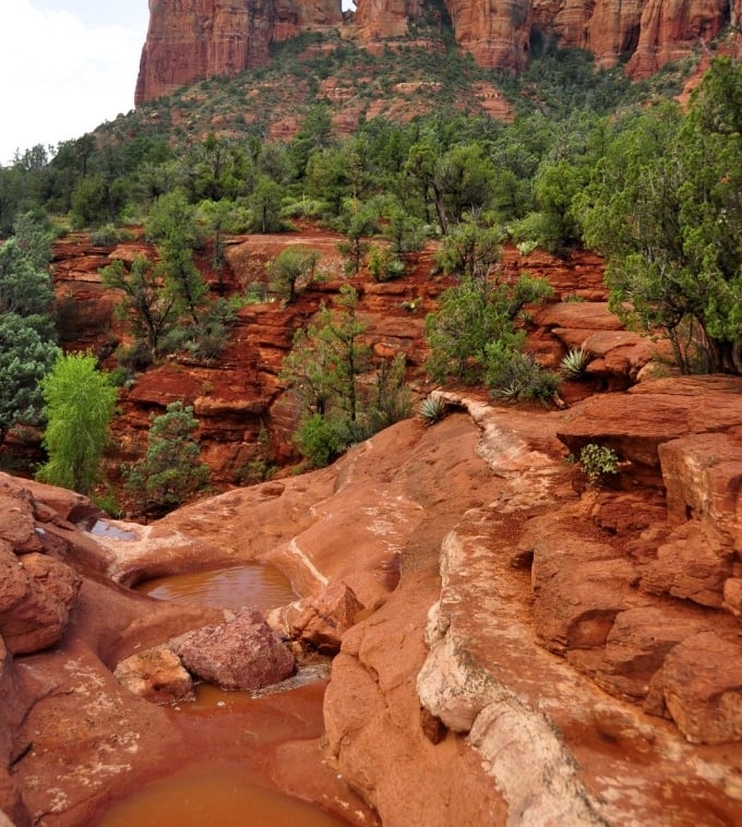
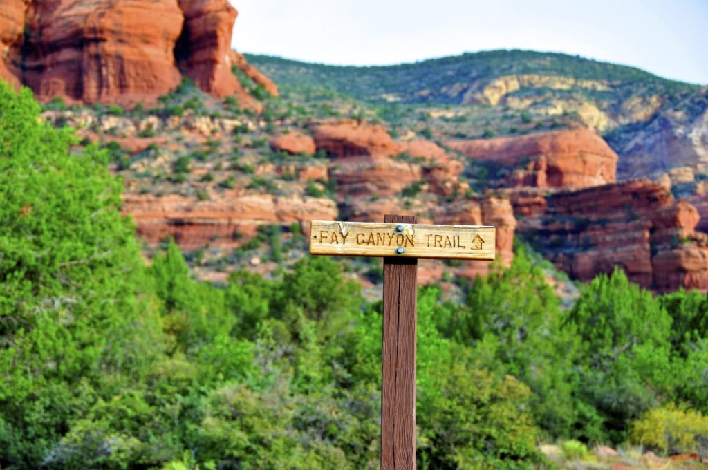
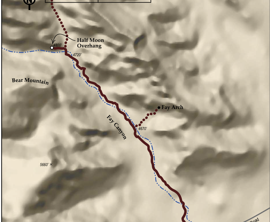
Fay Canyon
Fay Canyon is a great trail for the whole family. Unlike many trails that require you to go “down, across and up” numerous arroyos (dry creeks), Fay Canyon is actually relatively flat. It is one of those trails that starts out good and keeps getter better the further you make your way back into this box canyon. The high red rock cliff walls coupled with the large oak and juniper trees make this a great trail year-round.
Details
- Hiking Distance: One-Way: 1.2 mi | Total: 2.4 mi
- Trail Difficulty: Easy
- Elevation Min/Max: 4565 to 4757 ft
- Hiking Time: One Way: 40 min | Total: 80 min
- Trailhead GPS Coordinates: 34°54.105’ N, 111°51.472’ W
- Parking at Trail: 30 spaces
Directions
Start at L’Auberge. Left onto 89A 3.3 miles. Right onto Dry Creek Rd 2.9 miles. Left onto Boynton Pass Rd 1.6 miles. Left (again) Boynton Pass Rd 0.5 miles. Arrive at Fay Trailhead. Parking is on left.
Insider Info
This is an easy hike and it goes about one mile into the canyon. About half way in, there is a trail to the right that takes you up a hill to the arch which is pretty unique and has really nice views. (This portion is steep and our guests have suggested using hiking poles.) After you visit the arch, keep going the rest of the way to the end of the original trail. If you are at all adventurous, keep going! Another 100 feet up a steep climb are the best views by far! It’s not too difficult and only looks a little intimidating. Make it to the top where it opens out to a large flat area that has natural seating and views that go for miles! – Silvia Dieter, Marketing Coordinator
Broken Arrow
Behold the splendor of Munds Wilderness. This is one of our favorite areas to hike. Many hikers will avoid this trail because of the jeep traffic on a road parallel to the trail. Our belief is that the strength and diversity of this trail is so great that it overcomes the minor distraction of the jeeps. Enjoy the splendor of the red rock cliffs and canyons as you make your way along the trail. Don’t miss Devil’s Dining Room, which is .6 miles from the start of the trail, as you make you way to the pinnacle point of the trail…Chicken Point. (Additional trail link options include: Broken Arrow to Submarine Rock, Little Horse, Llama, Chapel and Bell Rock pathway.)
Details
- Hiking Distance: One-Way: 1.7 mi | Total: 3.4 mi
- Trail Difficulty: Easy to Moderate
- Elevation Min/Max: 4214 to 4640 ft
- Hiking Time: One Way: 1 hr | Total: 2 hrs
- Trailhead GPS Coordinates: 34.50729’ N, 111.45412’W
- Parking at Trail: 12 spaces
Directions
Start at L’Auberge. Left on 89A .2 miles. Left on AZ-179 1.0 miles. Left on Morgan Rd 0.6 miles. Stay straight down dirt road 0.1 miles. Arrive at Broken Arrow Trailhead. Parking is on left.
Insider Info
This is quite a rather unique hike as you work your way along the trail, you have extended canyons to one side and then high, impressive spires to the other. A great area where I like to rest and take in 360 degree views in on Submarine Rock. It’s no wonder tons of old westerns were shot in this scenic spot. – Nick Kulfan, Controller
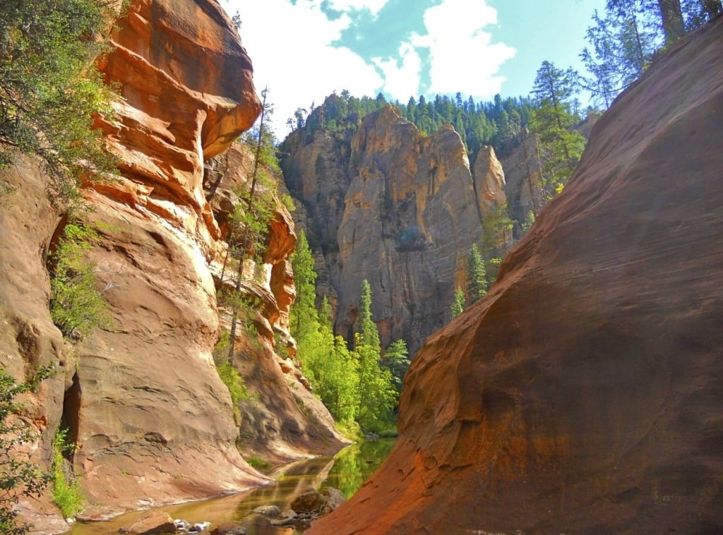
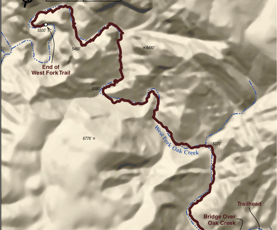
West Fork
This is it…the most iconic trail in the Sedona Red Rock Country. This trail captures unimaginable beauty, towering cliffs, perennial water that you cross 13 times and Old West history. Ruins of Mayhew Cabin mark the initial part of the trail, which was built by “Bear” Howard in the 1870’s. “Bear” earned his name by supposedly killing 4 bears with only a knife. In 1880, the Thomas family moved into the area and made Bear’s cabin into a lodge called Mayhew Lodge. Decades later (1924) the famous great American western novelist, Zane Grey, stayed at Mayhew Lodge and wrote the book Call of the Canyon which was later made into a movie. The lodge operated until 1968 and hosted many of Hollywood’s elite including James Stewart, Clark Gable and Walt Disney. The Forest Service took over the Lodge in 1968 and later (1976) burned to the ground. West Fork Trail will always hold a special place in many hearts.
Details
- Hiking Distance One-Way: 3.2 mi | Total: 6.4 mi
- Trail Difficulty: Easy to Moderate
- Elevation Min/Max: 4493 to 4725 ft
- Hiking Time One Way: 2 hrs | Total: 4 hrs
- Trailhead GPS Coordinates: 34°54.461’ N, 111°84.906’ W
- Parking at Trail: 30 spaces
Directions
Start at L’Auberge. Right onto 89A 10.6 miles. Arrive at West Fork Trailhead. Parking is on left.
Insider Information
On the warm dog days of summer…there is nothing more refreshing than West Fork. Being engulfed by the high, towering slot canyon walls provides great shade coverage to cool you down on even the warmest of days. Not to mention the thrill of feeling like a kid again as I frolick across the creek countless times. – Randy Beck, Concierge
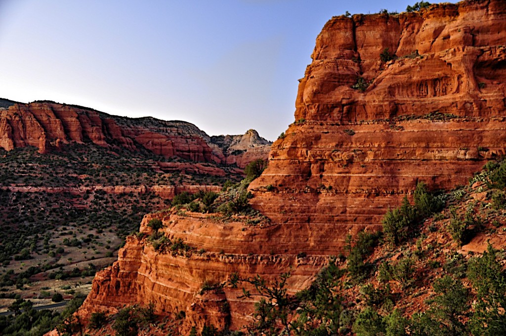
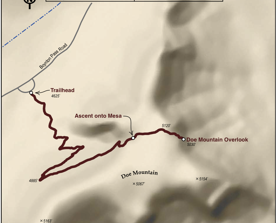
Doe Mountain
Doe Mountain Trail is one of the most popular trails in the Sedona Red Rock Wilderness—for good reason. Starting in the majestic Secret Mountain Wilderness, the trail quickly traverses up the side of Doe Mountain onto a relatively flat mesa. Once on top of the mesa, follow the rock cairns to the other side where you will be met with spectacular 360-degree red rock views. Note: As you approach the end of the trail please use caution. The trail ends on a ledge that drops off several hundred feet.
Details
- Hiking Distance: One-Way: 0.9 mi | Total: 1.8 mi
- Trail Difficulty: Moderate
- Elevation Min/Max: 4602 to 5126 ft
- Hiking Time: One Way: 45 min | Total 1.5 hrs
- Trailhead GPS Coordinates: 34°53.612’N, 111°51.944’W
- Parking at Trail: 21 spaces
Directions
Start at L’Auberge. Left onto 89A 3.3 miles. Right onto Dry Creek Rd 2.9 miles. Left onto Boynton Pass Rd 1.6 miles. Left (again) Boynton Pass Rd 1.2 miles. Arrive at Doe Mountain Trailhead. Parking is on left.
Insider Info
Sedona sunset’s are something truly amazing and should be enjoyed by everyone coming to Sedona. There is no better hike to do for sunset than Doe Mountain. I love being atop the mesa about an hour before sunset to witness the perfect lighting on our precious red rock which give it that great glow and illumination. Then as it gets closer to sunset, i like to work my way around the top of the mesa to face the west and catch some colorful clouds as the sunlight fades over red rock country.- Beau Franklin, Valet
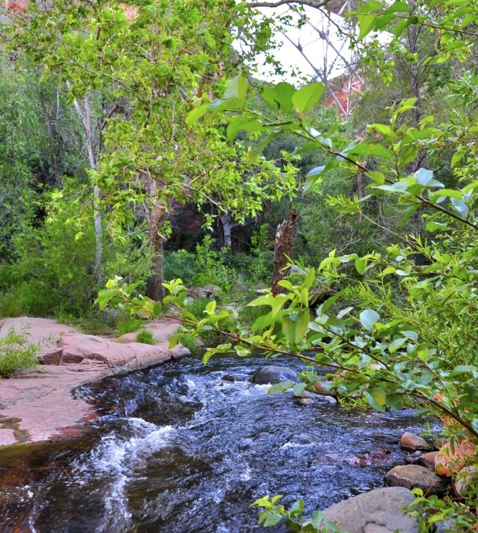
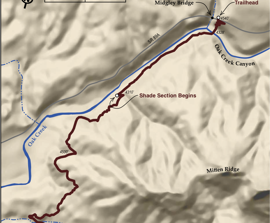
Huckaby
Water, H20, Agua, das Wasser, eau, mizu…no matter how you say it, water in the Southwest is something to behold. It is the lifeline for so many who have come here, who are here and for those who are to come. Huckaby trail is a well-disguised trail right in the heart of Sedona. While 1/3 of this hike is along Oak Creek, there is the other 2/3 of the trails that take you up and over several small canyons and bluffs. If you begin the trail at Schnebly Hill then do not underestimate the first 2/3 of the trail as it can be a little challenging. As you move into the mid point of the trail, you will find excellent views of Sedona, Wilson Mountain, Capitol Butte (Thunder Mountain) in the distance. As you near the final 1/3 of the trail you will drop down 200 hundred feet as you enter the lush riparian portion of the trail next to Oak Creek….this is a special place. Spend some time here and drink it in (literally).
Details
- Hiking Distance: One-Way: 2.5 mi | Total: 5 mi
- Trail Difficulty: Moderate to Difficult
- Elevation Min/Max: 4266 to 4466 ft
- Hiking Time: One Way: 1.5 hrs | Total: 3 hrs
- Trailhead GPS Coordinates: 34° 52.010’N, 111° 44.951’W
- Parking at Trail: 23 spaces
Directions
Start at L’Auberge. Left on 89A .1 miles. Left on Hwy 179 .3 miles. Left on Schnebly Hill Road 1 mile. Arrive at Huckaby. Parking on left.
Insider Info
What I love about this trail is that it not only provides a great overview of the popular formations of Sedona as well as an opportunity to visit the magestic Oak Creek. Even though Sedona is known and remembered for its red rocks, the creek which runs through it is just as special to me. I really enjoy the perspective of Sedona through the start of this as it makes red rock country seem so much larger than it really is. Then as you get about a mile and a half into the hike you seem to turn a corner as you peer up Oak Creek Canyon. After this there is no better way to break up a hike than to slowly decend down to the waters of Oak Creek, take a dip and maybe even enjoy a bottle of wine. – Rochelle Daniel, Executive Chef
Boynton Canyon Trail
Boynton Canyon Trail is a stunning hike through a picturesque canyon that moves you through a varied landscape. Make no mistake the real gem of this trail is found in the final 1/3 of the hike as you enter a high forest with large pines, oaks and even alligator junipers. The first 2/3 of the trail are really just a “means to the end” as you make your way through low growth scrub forest and along the east side of Enchantment Resort. As you hike this trail you will notice a stark contrast in temperatures as you leave the low growth, open red rocks in the first 2/3 and enter “the forest” and rise in elevation. The trail ends in grand fashion as it rises up and crescendos onto a quasi-plateau above tree tops.
Details
- Hiking Distance: One-Way: 3.2 mi | Total: 6.4 mi
- Trail Difficulty: Moderate
- Elevation Min/Max: 4488 to 5138 ft
- Hiking Time: One Way: 1.75 hrs | Total: 3.5 hrs
- Trailhead GPS Coordinates: 34°54.461’ N, 111°50.944’ W
- Parking at Trail: 30 spaces
Directions
Start at L’Auberge. Left onto 89A 3.2 miles. Right onto Dry Creek Rd 2.9 miles. Left onto Boynton Pass Rd 1.6 miles. Right Boynton Canyon Rd 190 feet. Arrive at Boynton Trailhead. Parking is on right.
Insider Info
Boynton Canyon was the first hike I did when I moved to Sedona 25 years ago. Not only is it in a stunning box canyon, but I love the numerous stories about the sacred Native American history of the canyon; Including the legend that it is the birthplace of the Yavapai and Apache tribe. – Catherine Powers, Spa Director
For more information on Sedona hikes, gear and more, visit TheHikeHouse.com.
No matter which hikes you choose, each will lead you through breathtaking red rock landscapes and stunning vistas. Take in the beauty and wonder of Sedona one step at a time.
If you’re looking for the perfect luxury basecamp for your Sedona hiking trip, L’Auberge de Sedona offers a quiet, secluded respite after a day on the trails. Browse our packages and offers and begin planning your Sedona getaway.
Posted: July 5, 2015

GlobalTravelerUSA.com: “L’Auberge de Sedona Announces ‘Home for the Holidays'”
L’Auberge de Sedona is spotlighted in the feature, “L’Auberge de Sedona Announces ‘Home for the Holidays’” on GlobalTravelerUSA.com. The article highlights the Home for the Holidays package as well as the holiday menus at Cress on Oak Creek for Christmas, and New Year’s Eve.

TravelandLeisure.com: “Best Places to Spend New Year’s Eve in 2021”
L’Auberge de Sedona is featured on TravelandLeisure.com highlighting must-visit cities for New Year’s Eve with intimate experiences focused on wellness and nature.

Condé Nast Readers Vote L’Auberge Top Hotel
Situated on the banks of Oak Creek in the heart of Sedona’s famed Red Rock country, L’Auberge de Sedona is a place where guests celebrate, connect, heal, and relax. We are truly honored to be recognized with Condé Nast Traveler 2021 Readers’ Choice Award as a Top Hotel in the Southwest!